The Grazing Pressure Report is designed to identify the area of different land types in specified grazing pressure zones in relation to watering points.
For this report to be effective, you will first need to have created your grazing pressure zones and mapped land types.
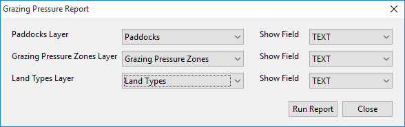
To run the Grazing Pressure Report:
•Click on Report in the drop-down menu, then select Grazing Pressure.
•In the Report selection window, select the corresponding layer from the drop-down lists.
•For each layer you can select the Object Data field you wish to display in the report. Click the drop-down list in Show Field to select desired field.
•Click on Run Report.