The Layer Intersection Report is designed to report all objects on one layer that intersect (cross or share space with) objects on another ‘base’ layer, and show data (area, length, count, yield etc) relating to those intersecting objects.
To run the Layer Intersection Report:
•Click on Report in the drop-down menu, then select Layer Intersection.
•In the Report selection window, select the Base Layer from the drop-down list. The base layer will identify the objects by which the report results will be grouped. For example, if the base layer is a Paddocks layer then the report will be grouped by the individual paddocks on that layer.
•Tick the fields of information to be published in the report for the grouping objects in the base layer. The order in which these fields appear on the report can be customised by dragging and dropping or by highlighting a field then using the up and down arrow buttons.
•Select the Intersecting layer from the drop-down list. The intersecting layer will contain the information that will be grouped by the base layer.
•Select the Group By field from the drop-down list. As an example, if the intersecting layer is land types, select the field that identifies the land type name.
•Click on Run Report.
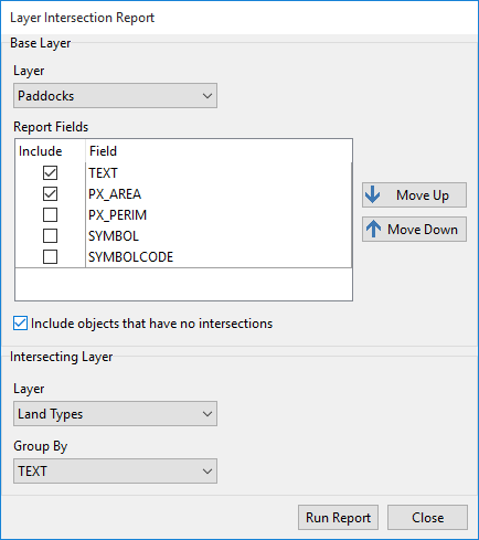
The example shown above will produce a report detailing the different land types found in each paddock, the area of each land type and the percentage of the paddocks this land type represents.