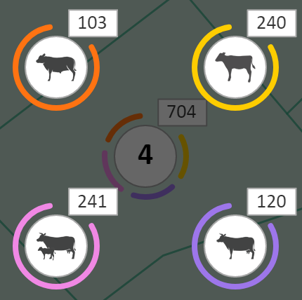
The Production Map is designed to give quick graphically based access to Livestock information in the form of an interactive map. Actions can also be completed to groups of animals via the map interface.
Map Projects will automatically generate from information contained within Phoenix Livestock and Phoenix Mapping that is in the same dataset. The map itself is derived from layers in current Mapping projects that have objects linked to Paddocks in the Livestock or Cropping modules. The projects will be named in accordance to the corresponding project in Phoenix Mapping.
If no projects are available then:
1.First, create a map of your paddocks in a Phoenix Mapping project
2.Then the paddocks in Phoenix Mapping need to be linked to the paddocks in Phoenix Livestock
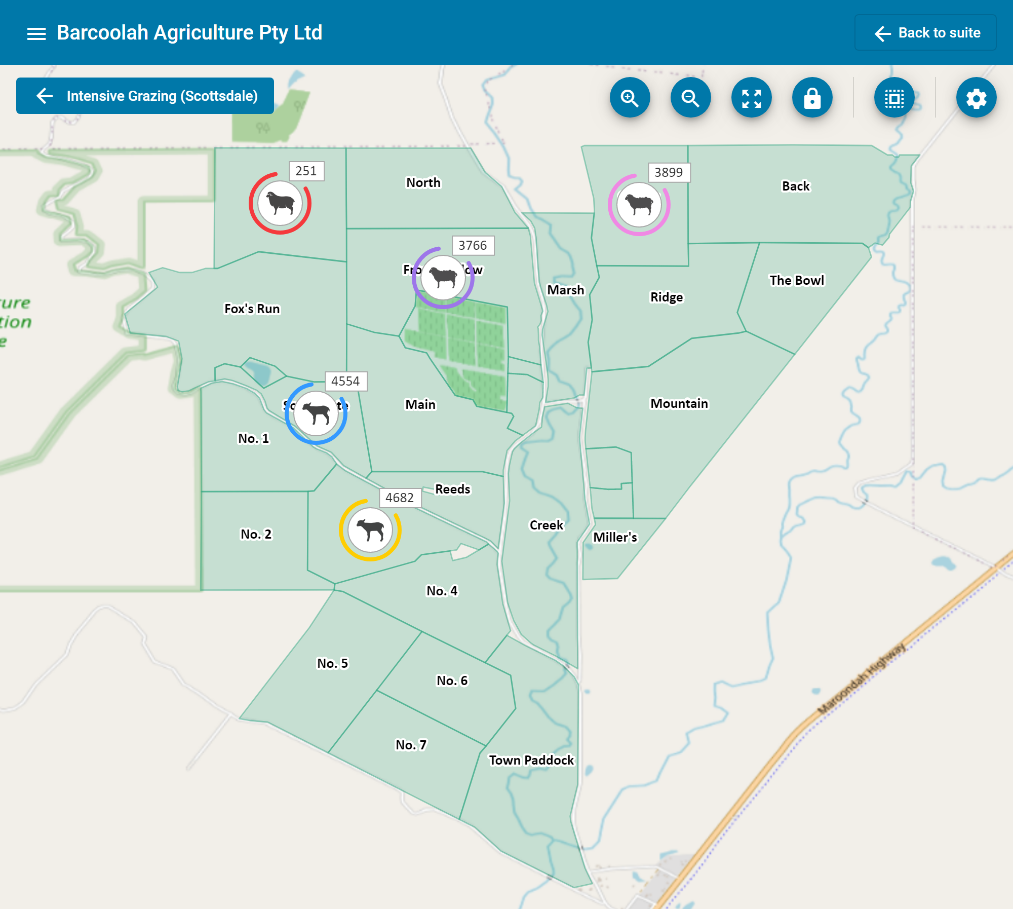
Default pins will be displayed on each map indicating the location of a mob or class of animals. At the top of the pin will be shown the headcount of the mob or class and hovering the mouse over the pin will display the name of the mob or class represented.

Where a location has more than one mob and/or class, a different style of pin will be shown with a number in the centre indicating how many unique mobs or classes are present with a total headcount shown at the top.
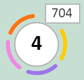
Clicking on the pin will display an exploded view of each mob or class present.
See more: