Any points marked on the map can be uploaded to the GPS as waypoints. To do this:
•Select the layer the points are on.
•On the GPS, select an Active Route. This is to start the GPS unit "talking".
•Then select any waypoint or track file and select to Track To/Make Active (this point can have no relevance to your map as it won’t be downloaded). You will need to refer to the GPS manual for instructions on how to do this.
•Click the GPS tab in the Pulldown menu (very top of the screen) and select Upload to GPS.
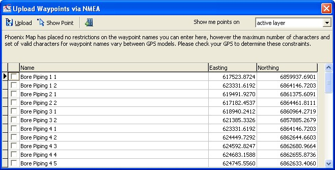
•This will present you with a table of points available. You can filter which points are in this table by selecting the relevant layer from the dropdown menu in the top right corner.
•To check which point you are about to upload, tick the point in the list and click the Show Point button. This will flash the point on the screen to confirm you have selected the right one.
•Tick the point/s you want to upload and click the Upload to GPS button.

NB: You can change the name of these points by double clicking on the Waypoint Name. This will put it in edit mode. Type in the new name and press Enter.