Symbols can be configured before or after objects are drawn.

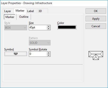
You can set the default symbol and corresponding formatting prior to drawing. •Select the layer in the layer list. •Click the Layer Properties •Click the + that best describes the type of symbol you are looking for. This will display an expanded list of symbols to select. As you click on each, an example is illustrated in the right hand section. Click OK.
•In this window you can edit the appearance or how the symbol will be drawn on the map. Select size, colour, orientation and gap (if on a lines layer). An example will appear in the bottom right hand corner. Click OK when finished.
• •Click on the layer wherever you wish to place that particular symbol then click Repeat steps for adding other symbol types. For objects like a shed, house, trough, tank, etc., they are placed on a Points Layer. To place power lines and railway tracks follow the same procedure however this time on a Lines Layer. |
 button then the Symbol button.
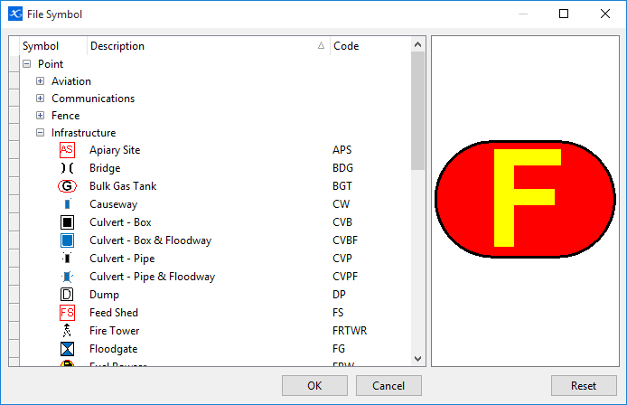

 Stop Drawing button when finished.
You can change an already drawn or marked symbol and its attributes by: •Select the layer the symbol is on. •Click on the symbol so the information for that object is seen in the Object Data tab. You can select multiple symbols by holding down the Ctrl key and pressing the A key to select ALL symbols on the layer or right mouse click and click Select All. You can also hold down the Ctrl key and left mouse click on the symbols separately to select a group of symbols. Selected symbols will be highlighted in red. •Click •From here you can change the symbol itself, size colour, orientation and in cases where the symbol is displayed in a line (i.e. railway line), the gap between the symbols along that line. •Once the changes have been made, click Apply to see the changes on the map then click OK.
Symbol Auto Sizing When zooming, the size of symbols (and labels), by default, remain in proportion to the project scale. Minimum and maximum fonts can be set along with the ability to have labels hide once the zoom gets beyond the minimum specified font size. for further information refer to Label/Symbol Zoom. |
 in Object Data tab.
©2020 AGDATA Holdings Pty Ltd trading as AGDATA Australia